
Map By Avantiputra7 [CC BY-SA 3.0 (https://creativecommons.org/licenses/by-sa/3.0)], from Wikimedia Commons
The country down on the right in the map picture is India. The early people we will be learning about lived in that brown area. All early people groups lived along rivers, around water. Why? They didn’t have pipes carrying water to them the way you do. They had to get the water for themselves. All life needs water. They needed water for themselves, their animals, and their crops to live. And since all animals need water, it was a good place to hunt. Water was their source of life, in that it provided their sources of food.
The blue lines on the map are rivers. The river flowing through that brown area is named the Indus. Can you guess another way the river was used, besides drinking water for plants and animals? It was also used for cleaning and for transportation. People could float themselves and their things down the river. Look at the picture below of the Indus Valley. Doesn’t it look easier to travel through by boat than over the hills?
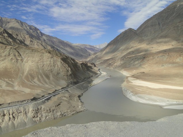
The Indus river starts high in some of the tallest mountains in the world and then runs all the way down into the Arabian sea. You can see in the picture how the valley forms around a river. The water cuts through the land. The picture shows the shape of a valley.
The Indus Valley civilization is one of the oldest. It is thought it developed around 5,000 years ago. A civilization is a group of people living together in an organized way. Together they were better protected and could help each other and learn from each other.
Other early civilizations were developing in Egypt, China, and Mesopotamia. In these civilizations some grew rich and lived in palaces but many were poor or even slaves.
The Indus Valley grew into a collection of towns and cities. The largest cities had over 150,000 people in them combined.
Here are some images we have from the work of archaeologists. Make observations.


All photographs on this page are in the public domain.